

Is Phoenix, United States Safe? A 2026 Travel Safety Guide
Extreme summer heat (50°C records), desert hiking deaths, haboob dust storms, monsoon thunderstorms, and the realistic risks of America's hottest big city.
Phoenix is one of America's safer Sun Belt cities for tourists. Crime against visitors is uncommon. The defining safety story of Phoenix is the extreme summer heat — 45°C (113°F) is normal in July; 50°C records have been set; heat-related deaths in metro Phoenix have hit 600+ in recent summers (mostly homeless, but tourists and hikers are over-represented in non-homeless deaths).
Beyond heat: desert hiking accidents (Camelback Mountain, Piestewa Peak — rescue calls almost daily in summer), haboob dust storms (summer monsoon season), monsoon flash floods, and the long-distance day-trip drives to Sedona (2h), Grand Canyon (3.5-4h), and Tucson (2h) that catch unprepared travellers.
The honest framing for first-time visitors: Phoenix is huge (~1.6 million city, 5 million metro), spread across the Salt River valley with mountains erupting through the urban grid. Most tourists stay in Scottsdale (the upscale spa-and-resort district), Old Town Scottsdale, downtown Phoenix, or Tempe (ASU). Best season is October-April; summer travel is genuinely punishing.
| Solo female safety | 80/100 |
|---|---|
| Night safety | 80/100 |
| Scam / petty-crime risk | Low |
| Violent crime (tourists) | Low |
| Most common scams | desert hiking accidents on Camelback Mountain; haboob dust storms during summer monsoon; flash floods during summer monsoon |
| Safer neighbourhoods | Old Town Scottsdale, North Scottsdale, Camelback Corridor |
| Data sources cited | 4 |
| Last verified |
What the score means — 80/100
- Healthcare (86) — Mayo Clinic Phoenix, Banner, HonorHealth are excellent.
- Personal safety (80) — high. Some downtown homeless concentration; Scottsdale resort areas are very safe.
- Transport (76) — Valley Metro light rail + buses cover central; rental car for day trips.
- Air quality (76) — pulled down by summer ozone, brown-cloud winter inversions, dust storms.
Extreme heat — the genuine deadly risk

- July-August: 38-46°C standard, 48-50°C records.
- Heat illness: heat exhaustion (headache, nausea, sweating) progressing to heat stroke (confusion, hot dry skin, no sweat — medical emergency).
- Maricopa County recorded 600+ heat deaths in 2023 alone — mostly homeless, but visitors and hikers regularly contribute.
- Hydration: 4-6L water/day minimum. Don't drink alcohol all day in heat.
- The "no hiking when over 105°F" rule: Phoenix has formal trail closures on extreme heat days. Heed.
- Pool drowning + heat: combinations of alcohol, heat, swimming. Several visitor deaths/year.
- Best season: November-April. December-February is genuinely pleasant (15-22°C).
Desert hiking — Camelback, Piestewa, the saguaros
- Camelback Mountain (Cholla and Echo trails): 366 m elevation gain, scrambling, exposed. Fitness required. Phoenix Fire averages 50+ Camelback rescues/year, mostly heat.
- Piestewa Peak: similar profile. Easier than Camelback but still serious.
- What to bring: 2-3L water/person, hat, sunscreen, sturdy shoes. Start at dawn in summer.
- What kills hikers: heat exhaustion → heat stroke. Rescue helicopters are routine in summer.
- The "Take a Hike, Do It Right" campaign: official Phoenix advice — read it.
- Saguaro etiquette: don't touch (legally protected; spines hurt). Don't wedge yourself into one for photos.
- Rattlesnakes: present on trails. Watch where you step. If bitten: don't apply tourniquet, don't suck out venom; get to ER (Phoenix hospitals have antivenom).
Monsoon — haboobs and flash floods
- Monsoon season: mid-June to mid-September. Brief intense thunderstorms, dust storms, flash floods.
- Haboob (dust storm): a wall of dust 1,500+ m high rolls across the desert. Visibility drops to zero in seconds. If driving: pull off, headlights off, foot off brake (so cars behind don't follow your lights into a stationary collision). Wait it out.
- Flash floods: dry washes flood violently. Don't drive through standing water — even shallow water hides washed-out roadbed. Arizona's "Stupid Motorist Law" (you pay for your own rescue from flooded crossings).
- Lightning: be off exposed peaks by mid-afternoon during monsoon.
Areas — Scottsdale, downtown Phoenix, Tempe
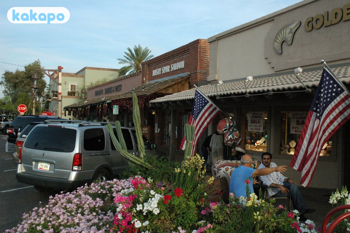
Recommended for visitors: Old Town Scottsdale (walkable bar/restaurant district, very safe), North Scottsdale (resorts, golf), Camelback Corridor / Arcadia (upscale residential, restaurants), downtown Phoenix (Roosevelt Row arts district, sports venues), Tempe / Mill Avenue (ASU college area).
Stay aware: downtown Phoenix homelessness corridor (along Madison Street near "The Zone" — visible distress, not violent towards passers-by). Maryvale and parts of South Phoenix have higher crime rates but aren't on tourist itineraries.
Day trips — Sedona, Grand Canyon, Tucson
- Sedona: 2 hours north. Red-rock landscape, hiking, "vortex" tourism. Hot in summer (35°C+) but cooler than Phoenix.
- Grand Canyon South Rim: 3.5-4 hours north. Long day; better as overnight at Grand Canyon Village.
- Antelope Canyon (Page): 5 hours. Spectacular slot canyons, only via Navajo-led tour.
- Tucson + Saguaro National Park: 2 hours south.
- Self-driving in summer: car AC failures are real; carry water + phone with charge. Watch for I-17 closures during haboobs.
Transport, taxis, the airport

- Valley Metro Rail: 1 light-rail line through Phoenix-Tempe-Mesa. Useful for some routes; doesn't reach Scottsdale resorts.
- Buses: extensive but slow in summer heat.
- Uber + Lyft: ubiquitous.
- Sky Harbor International Airport (PHX): 5 km from downtown. Sky Train + Light Rail $2 to centre. Taxi flat-rate $20 downtown / $30 Scottsdale.
- Rental car: practical for day trips. Bigger US sedan/SUV preferred for desert drives.
Money, food, the cost story
- Currency: US dollar.
- Tipping: 18-22%.
- Tax: 8.6% sales tax. Hotels add 12-14% combined.
- Cost: peak winter (Jan-March) hotels $300-700+/night; summer half that.
- Tap water: safe.
- Local food: Sonoran-style Mexican (carne asada, sonoran hot dog), upscale Southwest (Lon's at the Hermosa, FnB).
Practical info — emergency numbers
- Emergency: 911.
- Phoenix Police non-emergency: 602-262-6151.
- Mayo Clinic Phoenix ER: 480-301-8000.
- Banner University Medical Center ER: 602-839-2000.
- Arizona Poison Control (rattlesnakes): 1-800-222-1222.
Bring: serious sun protection (broad-brim hat, SPF 50+), refillable water bottles, hiking shoes, light hot-weather clothing, layered evening wear (cool desert nights), a contactless card, an unlocked phone, and US-valid travel insurance.
Frequently asked questions
Is Phoenix safe to visit in 2026?
Yes for crime — Phoenix is one of America's safer Sun Belt cities. Crime against visitors is uncommon and the central anchors (Old Town Scottsdale, North Scottsdale, Camelback Corridor, downtown Phoenix, Tempe) are calm. The defining safety story of Phoenix is the heat: 45°C is normal in July, 50°C records have been set, and Maricopa County recorded 600-plus heat-related deaths in 2023. Beyond heat, the realistic risks are desert hiking accidents on Camelback and Piestewa, haboob dust storms and flash floods during the summer monsoon, and the long-distance drives to Sedona (2h), Grand Canyon (3.5-4h) and Death Valley (5h).
Is Phoenix safe at night?
Yes in resort areas. Old Town Scottsdale, North Scottsdale and Camelback Corridor are calm and well-lit after dark. Downtown Phoenix is generally safe but has a visible homelessness corridor along Madison Street near "The Zone" — confronting rather than violent towards passers-by. Tempe's Mill Avenue area gets rowdy on ASU football weekends but is the standard college-bar pattern. Maryvale and parts of South Phoenix have higher crime stats but aren't on tourist itineraries. The bigger night-time risk is summer heat itself — outdoor dinners on a 38°C-at-9pm night still need hydration.
Is Phoenix safe for solo female travellers?
Yes — Phoenix and Scottsdale are easier for solo female travel than many US cities, with the resort culture making it normal to be alone in restaurants, spas and at pools. Uber and Lyft are cheap and ubiquitous. The genuine risks are heat-related and apply to everyone: never hike Camelback or Piestewa alone in summer, carry 2-3 litres of water per person, start at dawn and turn back early. Phoenix Fire averages 50-plus rescues per year on Camelback alone.
Can you drink tap water in Phoenix?
Yes — Phoenix tap water is treated by the city's Water Services department from Salt River Project and Central Arizona Project sources, and is safe everywhere in the metro area. The taste is mineral-heavy because of desert geology and the Colorado River source; many visitors prefer filtered or bottled water. A refillable bottle is essential — heat exhaustion is the most common visitor medical emergency. Several heat-related deaths each year combine alcohol, all-day pool exposure and inadequate water.
What's the biggest scam to avoid in Phoenix?
Phoenix has very little organised scam culture. The recurring practical traps are unofficial Sedona and Grand Canyon "private tour" brokers (book licensed operators directly), aggressive timeshare presentations pitched as discounted attraction tickets at I-17 "welcome centers" (privately-run pitch facilities, not state welcome centres), and rental-car insurance hard-sell at Sky Harbor (most US credit cards already cover rentals; check first). Don't get rescued by a tow-and-rescue outfit from a flooded wash crossing — Arizona's "Stupid Motorist Law" requires you to pay for your own rescue when you drove around the barricades.
How do I safely hike Camelback Mountain in summer?
Honestly, don't hike Camelback in summer if you can avoid it. Phoenix has formal trail closures on days when temperatures exceed 105°F (41°C) and Phoenix Fire averages over 50 Camelback rescues per year, almost all heat-related. If you must go in summer, start before dawn (4:30-5am turnaround), carry 2-3 litres of water per person, wear a hat and sunscreen, take the easier Cholla Trail rather than Echo, and turn back at the first sign of heat illness (headache, nausea, dizziness). Heat stroke (confusion, hot dry skin without sweating) is a medical emergency. The best Phoenix hiking season is November-April; come back then. Watch for rattlesnakes year-round and don't touch the saguaros (legally protected and the spines hurt).