

Is Palo Alto, United States Safe? A 2026 Travel Safety Guide
The heart of Silicon Valley, Stanford University, the tech-money town, the Caltrain corridor, and the realistic risks.
Palo Alto is one of the wealthiest small cities in the US — Stanford University on its western edge, Hewlett, Packard, Google, Tesla, and many other tech founders' garages, and a downtown (University Avenue + California Avenue) of upscale restaurants + shops. Crime against visitors is essentially nil; Palo Alto consistently ranks among the safest mid-size US cities. The realistic concerns are car break-ins (the Bay Area has a documented rental-car-window-smashing problem at trailheads + parking lots), the high cost (hotels $250-600/night), the limited public transport beyond Caltrain, and the suburban-car culture (you'll want a car or rideshare).
Most international visitors to Palo Alto are here for tech meetings, Stanford, or as a quieter base for visiting San Francisco (45 min by Caltrain). Stanford campus + the Cantor Arts Center + Hoover Tower + Stanford Stadium are visitor anchors.
The texture is unusual for the US: pavements actually used, cyclists everywhere (Stanford's commuting bike volume is among the highest in America), Spanish-tile and Eichler mid-century houses on tree-shaded streets that sell for $4-8 million, and a downtown of low-rise brick buildings that feel more like a wealthy small-town California Main Street than a tech metropolis. The Caltrain corridor splits the city north-south; west of the tracks is Stanford's land and the older money, east of the tracks is the more recent tech sprawl. There is no skyline — the city has hard low-rise zoning. The result is a place that feels, by US standards, almost European in walkability while remaining unmistakably suburban in everything else.
| Violent crime (tourists) | Low |
|---|---|
| Data sources cited | 3 |
| Last verified |
What the score means — 88/100
- Healthcare (96) — Stanford Hospital among the world's best. Stanford Children's Hospital adjacent.
- Personal safety (92) — among the safest US cities of its size.
- Air quality (84) — generally good; degraded during California wildfire season (Aug-Oct).
- Transport (78) — Caltrain corridor + buses; car-dependent for most things.
Areas — University Ave, California Ave, Stanford
Recommended for visitors: Downtown / University Avenue (restaurants, hotels, walkable to Caltrain), California Avenue (smaller second downtown, farmers' market Sundays), Stanford campus (free to walk; Hoover Tower observation $4), Crescent Park + Old Palo Alto (residential, leave residents alone).
Stay aware: around East Palo Alto (separate city, east of Highway 101) — historically higher crime; mostly fine but visitors usually have no reason to go.
Bay Area car break-ins
- The pattern: rental-car windows smashed at trailheads, scenic overlooks, restaurant lots. Bay Area-wide.
- Don't leave anything visible: in a car, ever. Empty trunk + visible-empty seats.
- Even if it's "just a backpack": thieves hit + run in 30 seconds.
- Hotel valet: safer than street parking for overnight.
- Stanford Dish hike + Foothills Park trailheads: known hotspots.
Transport — Caltrain, the airports
- Caltrain: Palo Alto + California Ave stations on the SF ↔ San Jose corridor. SF in 45-60 min.
- Marguerite shuttle: free Stanford-area shuttle.
- Uber + Lyft: both work.
- SFO: 35 km north. Caltrain + BART or Uber $50-90.
- SJC (San Jose): 25 km south. Uber $30-60.
Money + cost
- Currency: USD.
- Cards: tap-to-pay universal.
- Tipping: 18-22% restaurants.
- Cost: among the most expensive US suburbs. Mid-range hotels $250-500.
- Tap water: safe.
Neighbourhoods — Stanford, University Ave, College Terrace, Embarcadero
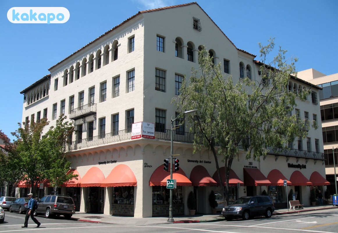
- Downtown / University Avenue — the main commercial spine east of the Caltrain station. Restaurants, mid-priced retail, the historic Stanford Theatre, the Apple Park / VC office cluster. Walkable, well-lit, busy until ~22:00 weekdays and later on weekends.
- California Avenue — the second downtown, about 2 km south. Smaller, calmer, a Sunday farmers' market, more local Stanford-faculty energy. Caltrain stops here too.
- Stanford campus — 8,180 acres west of El Camino Real. Free to walk; Hoover Tower observation deck is $4 and worth it for the orientation. The Main Quad, Memorial Church, the Cantor Arts Center (Rodins) and the Anderson Collection are the cultural anchors. The campus has its own police (Stanford DPS).
- College Terrace — tiny grid of streets immediately south of campus between California Ave and Stanford. Old-money academic housing, leafy, very quiet, the kind of neighbourhood where Stanford emeritus professors walk dogs.
- Old Palo Alto / Crescent Park — the historic residential heart east of Alma Street between Embarcadero and Oregon Expressway. Eichlers, Spanish revivals, Steve Jobs's old house. Stunning streets to walk; respect that this is private residential and there are no public attractions.
- Embarcadero Road corridor — runs east from El Camino to the Bayshore; restaurants at the western end, the Palo Alto Baylands Nature Preserve at the eastern (genuinely good birdwatching, salt marshes, the duck pond).
- Caltrain corridor — Palo Alto Caltrain (downtown) and California Ave Caltrain are both on the main SF-San Jose line. Baby Bullet expresses to SF 4th & King take ~37 minutes; local trains 60-75 minutes. Tap with a Clipper card or contactless on the new validators (rolled out 2024).
- Stay aware: East Palo Alto is a separate city east of Highway 101 with historically higher (though greatly improved) crime rates — most visitors have no reason to be there. The trailhead lots at Stanford Dish, Foothills Park and Arastradero Preserve are documented car-prowl hotspots — leave nothing visible.
- Stanford Shopping Center — open-air upscale mall on the north edge of campus. Easy access, plenty of parking, Apple Store, Tesla showroom.
If it's your first time in Palo Alto
- Arrival: SFO (35 km north) is the international choice; Caltrain + BART combo or Uber for $55-90. SJC (San Jose, 25 km south) is cheaper for domestic — Uber $30-60. OAK (Oakland) is the wild card.
- Where to stay: Downtown / University Avenue cluster (Westin, Sheraton, Garden Court) for walkable food and easy Caltrain. Stanford Park Hotel / Rosewood Sand Hill for the upscale Stanford-adjacent experience ($600-1,200/night). Avoid booking off-El Camino without a car.
- Car break-ins are the actual safety issue — Stanford Dish trailhead, Arastradero Preserve, Foothills Park, hotel street parking, restaurant lots after dark. Leave nothing visible, ever. Empty seats, empty trunk. Thieves work in 30 seconds.
- Day 1 plan: morning at Stanford (Main Quad, Hoover Tower, Memorial Church, Cantor Arts Center — 3-4 hours), lunch on University Avenue, afternoon stroll Old Palo Alto residential streets, evening dinner downtown.
- Day 2 — into San Francisco: Caltrain Baby Bullet at 8:14am or 9:24am gets you to 4th & King in ~37 minutes. Return by 9pm on the Baby Bullet to avoid the late slow trains.
- Common rookie mistakes: assuming Stanford is "the campus" of the city (it owns most of the western half of Palo Alto and is technically unincorporated Santa Clara County land); leaving anything visible in the rental car; eating only at the chains on El Camino when University Avenue is right there; driving to SF (parking is $40-80/day, traffic kills you, take Caltrain).
- Tap water: from the SF Hetch Hetchy system — same Sierra snowmelt that serves San Francisco. Excellent. Refill stations on Stanford campus.
- Tipping: 18-22% restaurants; round up for coffee shops; $1-2/drink at bars; 18% Uber default.
- What surprises Europeans: distances ("walkable" means a different thing here), how much you tip, how much hotels cost ($300-500 mid-range), how good the espresso is (Stanford has trained a generation of barista perfectionists), and how little nightlife there is past 23:00.
Practical info — emergency numbers
- Emergency: 911.
- Palo Alto Police (non-emergency): +1 650 329 2413.
- Stanford Hospital: +1 650 723 4000.
Bring: layered clothing (cool mornings even in summer), a US SIM/eSIM, contactless card, comfortable shoes for Stanford campus walking, sunscreen, travel insurance with full medical coverage.
Frequently asked questions
Is Palo Alto safe to visit in 2026?
Yes — Palo Alto scores 88/100 here, consistently among the safest mid-size US cities. UK FCDO keeps the US at low advisory levels. Violent crime is rare, the Stanford campus and University Avenue are heavily patrolled, and the residential streets of Old Palo Alto and Crescent Park are quiet at any hour. The realistic risk for visitors is car break-ins — the broader Bay Area's window-smashing pattern reaches Palo Alto's trailhead parking lots, hotel street parking, and the lots around Stanford Stadium on event days. Don't leave anything visible in a vehicle, ever.
Is Palo Alto safe at night?
Yes. University Avenue restaurants stay busy until 10-11pm, California Avenue is calm but populated, Stanford campus is well-lit with its own dedicated Stanford Department of Public Safety, and residential Palo Alto is sleepy and benign. There is no real after-dark danger zone within Palo Alto itself. East Palo Alto (a separate city across Highway 101 with historically higher crime, though it's improved markedly over the past decade) is where visitors occasionally wander by mistake — Uber is the sensible choice for late-night moves rather than walking unfamiliar blocks. The Caltrain station area is well-lit until the last train (around midnight).
What's the biggest risk for visitors in Palo Alto?
Bay Area car break-ins — and Palo Alto is not exempt despite its safe reputation. The pattern is well-documented: rental-car windows smashed at trailheads (Stanford Dish, Foothills Park, Arastradero Preserve), at scenic overlooks, in restaurant parking lots, and occasionally outside hotels. The thieves work in 30 seconds and are gone. Leave the car visibly empty — no backpack, no jacket on the seat, no shopping bags in the back. Empty the trunk too if you've been seen putting things in it. Hotel valet or garage parking is safer than street parking overnight. This is the single most actionable safety advice for Bay Area visitors.
Can you drink tap water in Palo Alto?
Yes — Palo Alto's tap water (supplied by the SF Hetch Hetchy system, the same gravity-fed Sierra Nevada snowmelt that serves San Francisco) is among the highest-quality municipal supplies in the US. It's tested constantly, tastes excellent, and locals drink it routinely. Carry a refillable bottle — Stanford campus has filtered-water bottle fillers throughout. There's no reason to buy bottled.
Is Palo Alto a sensible base for visiting San Francisco?
Yes — many tech-business travellers do exactly this. Palo Alto offers calmer, safer, more upscale lodging than central San Francisco, with Caltrain running roughly every 30 minutes between Palo Alto station (downtown) or California Avenue station and San Francisco's 4th & King station in 45-60 minutes. The downside is cost: Palo Alto hotels run $250-500/night for mid-range, and dining is priced to match the tech-money baseline. SFO is 35km north (Caltrain + BART transfer, or Uber for $50-90); San Jose International (SJC) is 25km south and the cheaper option (Uber $30-60). For visitors prioritising Stanford, calm and personal safety over SF nightlife, it's a good base.