

Is Boston, United States Safe? A 2026 Travel Safety Guide
Brutal nor'easter winters, the T transit reliability, the cobbled Beacon Hill, and the realistic risks of one of America's safer big cities.
Boston is one of America's safer large cities for tourists. Crime against visitors is uncommon. The realistic risks are environmental and infrastructural rather than crime: the genuinely brutal nor'easter winters (-15°C with snowstorm-driven shutdowns), the famously inconsistent MBTA "T" transit reliability, the slippery cobbled streets of Beacon Hill on icy or rainy days, and the standard pickpocket caution at Faneuil Hall and Quincy Market.
The honest framing for first-time visitors: Boston is medium-sized for an American big city (~675,000 in city, 4.9 million metro), walkable in a way few US cities are, and built around the harbour and the Charles River. The Freedom Trail (a painted red line through 16 historic sites), Beacon Hill, the Public Garden, Harvard and MIT in Cambridge, Fenway Park, and the North End (Italian neighbourhood) are the visitor anchors.
| Scam / petty-crime risk | Medium |
|---|---|
| Violent crime (tourists) | Low |
| Most common scams | pickpockets at Faneuil Hall and Quincy Market |
| Safer neighbourhoods | Beacon Hill, Back Bay, North End |
| Data sources cited | 4 |
| Last verified |
What the score means — 86/100
- Healthcare (92) — Mass General, Brigham, Beth Israel are world-class. Boston is the global capital of academic medicine.
- Personal safety (86) — high. Boston is small-feeling and low-crime in tourist neighbourhoods.
- Air quality (86) — clean coastal.
- Transport (80) — pulled down by MBTA reliability issues (shutdowns, slow zones since 2022).
Winter — nor'easters and ice
- December-March: -5 to -15°C standard, with windchill colder.
- Nor'easters: major storm systems combining heavy snow + strong winds. 30-90 cm snowfalls happen. Flights cancel; T shuts; some streets close.
- Slippery cobbles: Beacon Hill's brick sidewalks become icy. Boots with grip mandatory.
- Frostbite: at -20°C with wind in 15-20 minutes on exposed skin.
- Best summer: June-September. 22-30°C. Humid.
- Fall colours: late September - mid October. The classic New England drive (1-2h north into NH/VT) is the photo trip.
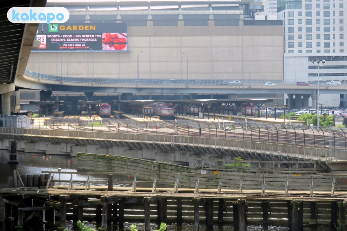
The T (MBTA) — the reliability conversation

- The MBTA "T": subway (Red, Orange, Blue, Green, Silver lines), commuter rail, buses, ferries. America's oldest subway.
- Reliability complaints (2022-onwards): extensive "slow zones" due to deferred maintenance. Some segments crawl at 10 mph. Closures, single-tracking, and bus-bridges are common.
- Practical advice: build buffer time. Check MBTA alerts (mbta.com or the app) before you set out. Some routes are simply faster on foot.
- Safety on the T: incidents are rare. Standard subway awareness applies.
- Cost: $2.40 single with CharlieCard, $11/day pass. Tap-to-pay on most stations.
Areas — Beacon Hill, Back Bay, Cambridge, North End

Recommended for visitors: Beacon Hill (gas-lit lanes, brick sidewalks), Back Bay (Newbury Street shops, Copley Square, Public Garden), North End (Italian neighbourhood, restaurants), Cambridge / Harvard Square (across the river), Seaport District (modern waterfront), Fenway / Kenmore Square.
Stay aware: Mass and Cass area (the methadone-mile concentration of homelessness; been the subject of city policy attention 2022-onwards). Some Roxbury / Mattapan / Dorchester corners have higher crime rates but aren't on tourist itineraries.
Boston has no specific "no-go" zones in tourist neighbourhoods.
The Freedom Trail

- The Freedom Trail: 4 km painted red line on sidewalks linking 16 historic sites — Boston Common, Massachusetts State House, Granary Burying Ground, Old North Church, USS Constitution, Bunker Hill Monument.
- Walking the full thing: 3-4 hours with stops. The Bunker Hill Monument is a 294-step climb without elevator.
- Ranger-led tours: free, informative.
- Pickpockets at Faneuil Hall + Quincy Market: present in summer crowds.
Transport — taxis, the airport
- Walking: Boston is genuinely walkable. The compact centre is the easiest American big-city tourist walk.
- Uber + Lyft: cheap, ubiquitous.
- Logan Airport (BOS): 5 km north-east of downtown. Silver Line bus FREE inbound to South Station. Blue Line subway $2.40 to centre. Taxi $25-35.
- Parking: scarce and expensive. Don't drive in central Boston unless necessary.
Money, food, lobster
- Currency: US dollar.
- Tipping: 18-22%.
- Tax: 6.25% Mass. sales tax. Hotels add 14.45% combined.
- Cost: hotels $250-450/night standard.
- Tap water: safe.
- Local food: clam chowder, lobster roll (hot with butter is "Connecticut-style", cold with mayo is "Maine-style", Boston sells both), Italian from the North End (Mike's Pastry, Modern Pastry for cannoli).
Freedom Trail + Fenway + the practical Boston circuit
Boston is small + walkable by US-city standards. The big-three tourist anchors — Freedom Trail, Fenway Park, Harvard / MIT — can all be done in 3-4 days. The neighbourhoods are distinct and walking + the T (subway) connect everything.
- Freedom Trail: 4 km red-brick line painted on the pavement, connecting 16 colonial + revolutionary sites. Free, self-guided. Start at Boston Common; walk to USS Constitution in Charlestown over 3-4 hours. Most-photographed stops: Massachusetts State House (gold dome), Faneuil Hall, Paul Revere House, Old North Church, Bunker Hill.
- Free walking tours of the Freedom Trail: Boston By Foot + Boston National Historical Park rangers run good ones. Pre-book or check posted schedules at the Visitor Centre on the Common.
- Fenway Park (Red Sox): April-October. The oldest active MLB stadium (1912). Pre-game stadium tours run year-round ($25); game tickets $30-300+ from MLB.com or StubHub.
- Harvard + MIT campus walks (Cambridge): 15 min on the Red Line from downtown. Free; Harvard Yard is open; MIT's "Infinite Corridor" + the Stata Center are the famous photos.
- Museum of Fine Arts (MFA) + Isabella Stewart Gardner: adjacent in the Fenway neighbourhood. Both world-class. Gardner Museum's 1990 art-heist is still unsolved (empty frames remain on the walls).
- North End: Boston's Little Italy. Hanover Street + the surrounding lanes. Pizzeria Regina, Mike's Pastry vs Modern Pastry (the cannoli rivalry).
- Charlestown + Bunker Hill: across the Charles River. Walk the Constitution Bridge for the skyline view.
- South End + Back Bay: Boston's gentrified Victorian brownstone neighbourhoods. Newbury Street shopping.
Winter cold, marathon weekend, and the events calendar
- Winter (Dec-Mar): -5 to 5 °C, snow common, occasional nor'easter storms that close transit. Layered clothing essential; waterproof footwear non-negotiable.
- Summer (Jul-Aug): 25-32 °C with humidity. Brief afternoon thunderstorms common.
- Best season: late September through October — peak New England fall foliage in the surrounding mountains (White Mountains, NH; Berkshires, MA; Vermont). Late May through June also lovely.
- Boston Marathon (3rd Monday of April, Patriots' Day): 30,000 runners + 500,000+ spectators. Hotels +200-400%; Back Bay area heavily-restricted on race day. Marathon weekend (Sat-Mon) sells out 6+ months ahead.
- Patriots' Day (3rd Monday of April): state holiday in Massachusetts. Lexington + Concord battle reenactments at dawn. Marathon runs the same day.
- July 4th + Boston Pops Esplanade Concert: free concert + fireworks on the Charles River. 500,000+ on the Esplanade. Arrive 6+ hours early for a lawn spot.
- Head of the Charles Regatta (late October): world's biggest rowing event. Charles River banks packed.
- Worst weeks for visitors: late February to early March (cold, no events). January after New Year's, before MLK Day.
Practical info — emergency numbers
- Emergency: 911.
- Boston Police non-emergency: 617-343-4200.
- Massachusetts General ER: 617-726-2000.
- Brigham and Women's ER: 617-732-5500.
Bring: warm clothing if Nov-March, boots with grip, comfortable walking shoes, a contactless card, an unlocked phone, and US-valid travel insurance with full medical coverage.
Frequently asked questions
Is Boston safe to visit in 2026?
Yes. Boston is among the US's safer larger tourist cities. Tourist core (Beacon Hill, Back Bay, North End, Seaport, Fenway, Harvard Square) is heavily-policed + walkable. Real concerns: winter ice (Dec-Mar), summer heat humidity in July-Aug, T delays, and the Marathon weekend (April) + St Patrick's Day crowd density.
Is Boston safe at night?
Yes for central Boston. Faneuil Hall + Seaport + the Greenway are alive late + well-policed. T runs until 12:30am weeknights / 1am weekends. Use Uber/Lyft for late-night Cambridge transfers + for the few outer Roxbury / Mattapan zones tourists rarely visit.
Is the T (Boston subway) safe?
Yes. The MBTA Green/Red/Orange/Blue lines are safe with standard urban awareness. The system shows its age (delays, slow zones) but crime against tourists is rare. Last train ~12:30am — plan late-night transfers via Uber/Lyft.
Is Boston safe for solo female travellers?
Yes. Boston ranks well on solo-female-safety indices for US cities. Standard precautions: phone in pocket on the T off-peak, watch drinks in Seaport nightlife, use rideshare for late-night transfers. Women routinely walk Beacon Hill + Back Bay + Cambridge solo at all hours.
Can you drink tap water in Boston?
Yes — Boston tap water is excellent (sourced from Quabbin Reservoir). Drinkable + free at every restaurant.
When is the worst time to visit Boston?
January-February (cold + icy). Marathon weekend (third Monday in April — hotels surge 3-5x). Independence Day weekend (Pops concert at the Esplanade is packed). Best Boston weather: late May-October. Fall foliage (mid-October) is the photogenic peak.